Up, up and away. Forest Service looking at special balloons to monitor big wildfires


The U.S. Forest Service is looking at something different — very different — to improve situational awareness at big wildfires: high altitude balloons.
The Forest Service and NASA have teamed up to evaluate the use of remote controlled balloons that can loiter high above fire scenes. The federal agencies are working to finalize a contract with South Dakota-based Aerostar, which has decades of experience flying uncrewed balloons for scientific and military missions.
Earlier this month, Aerostar piloted its huge Thunderhead Balloon system over a large wildfire in central Idaho – the Moose Fire – in a demonstration. The balloon controllers adjusted the stratospheric altitude a little up or a little down to catch different wind directions to hold station over the target for 11 days. The helium balloon carried a solar-powered sensor and transmitter package with visual and thermal cameras that could see through smoke. It hovered between 60,000-70,000 feet.
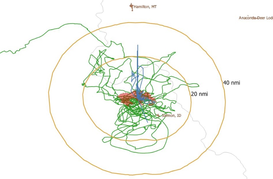
"Folks in the area of the Moose Fire may have noticed a strange, reflective object in the sky last week," a Salmon-Challis National Forest spokesperson wrote in a Facebook post. "It wasn't a bird or a plane, and it wasn’t exactly a weather balloon, either. It was STRATO, or Strategic Radio and Tactical Overwatch, a new technology."
In the future, Aerostar said the balloon could also act as a remote cell tower and it could relay location tracking signals between front-line units and incident command. Existing cellular and radio communication are spotty in the rugged mountains of central Idaho where the Moose Fire continues to burn, a common problem at Western wildfire scenes.
This gets at what one firefighting insider blog called "the Holy Grail" of wildland fire safety – namely, giving fire commanders a real-time view of where the flames are burning in relation to where firefighters are deployed.
"Lacking this information has led to at least two dozen firefighter fatalities," wrote Bill Gabbert on the Fire Aviation website Thursday.
"We see stratospheric balloon technology being the key to cost-effective, scalable wildfire surveillance," Aerostar communications director Lisa McElrath elaborated to Gabbert.
The Aerostar balloon is one of several high-altitude, long endurance drone technologies under evaluation by the federal wildfire research and development division. More flights with the balloon are planned. Last summer, Aerostar piloted its balloon on the company's own initiative over four different large wildfires in Montana, Idaho, Washington and California in one long 70-day mission.
Another platform under evaluation is the spindly-looking, solar-powered Swift HALE UAS drone, designed by California-based Swift Engineering. This winged aircraft can provide continuous remote sensing from an altitude between 55,000 and 70,000 feet for up to 30 days at a time.
Federal and state wildland firefighting agencies have previously run trials above active fires with a civilian version of the smaller ScanEagle military reconnaissance drone made by Boeing subsidiary Insitu in the Columbia River Gorge.
This story has been updated.
Copyright 2022 Northwest News Network
-
Tom Banse

Regional Correspondent
Tom Banse covers national news, business, science, public policy, Olympic sports, and human interest stories across Washington state. Now semi-retired, Banse is an Olympia-based reporter with more than three decades of experience covering the Pacific Northwest. Most of his career was spent with public radio's Northwest News Network, but now in semi-retirement his work appears on multiple nonprofit news outlets including KUOW. His recent areas of focus range from transportation, U.S.-Canada borderlands, the Northwest region's planned hydrogen hub, and emergency preparedness.
More stories from Tom Banse »