Commission Urges Mapping Of All Washington Landslide Zones

A state commission on landslides is urging nearly two dozen improvements in the way Washington state prepares for and responds to landslides.
Statewide mapping of landslide hazards, better funding and coordination for emergency responders, and "innovative" land-use regulations to improve public safety top the commission's preliminary list.
The SR 530 Landslide Commission's final recommendations aren't due to Gov. Jay Inslee until Dec. 15. But at a commission meeting in Everett Tuesday night, most of the 22 recommendations in a Nov. 28 draft provided to KUOW provoked little controversy beyond wordsmithing and are likely to remain substantially unchanged.
Inslee and Snohomish County Executive John Lovick established the commission in July, four months after the deadly Oso landslide.
Only about 13 percent of Washington has been mapped for landslides, leaving government and the public largely in the dark on the hazards and risks they may be exposed to. The commissioners are calling for a big push to map the rest of the state, so builders and buyers can know where it's safe to live or build.
Sponsored
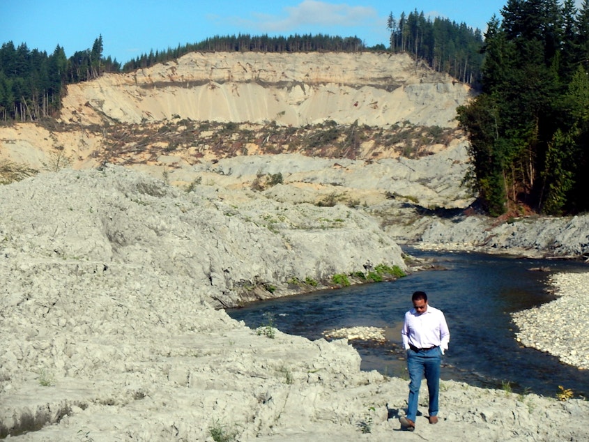
At the Tuesday meeting, commissioners largely agreed that government needs to do a better job of responding to landslide disasters -- from mobilizing official responders to incorporating skilled volunteers. Loggers and construction workers from the Darrington area played a big role in pulling survivors and 43 bodies from the muddy wasteland created by the massive Oso slide.
"They're very knowledgeable about working in sort of chaotic environments," commission director Kathy Lombardo said. "So they were very, very helpful for the first responders and all the other responders that came."
Commissioners had a harder time agreeing on funding for landslide studies and how the Washington Department of Natural Resources and other government entities should revamp their efforts to keep people from living or logging too close to landslide zones.
"To do this well will take some unconventional thinking in these budgetary times," said commissioner and University of Washington geologist David Montgomery.
Pat Stevenson with the Stillaguamish Tribe attended the meeting and praised the commission's quick work. But he said any proposals for new land-use regulations will be a tough sell in the Stillaguamish Valley, even after the Oso landslide there.
Sponsored
"There's a sort of anti-government mentality in parts of the valley," Stevenson said. "I think they have to make sure they have their science behind them and do a good public outreach effort to make sure they're selling that to the community and it's valid."
While the state's Growth Management Act generally aims to steer development away from both dangerous and environmentally sensitive areas, the state lets local jurisdictions decide the specifics.
Commissioners -- a mix of experts and elected officials -- on Tuesday hammered out language to describe how the resulting hodgepodge of landslide regulations across the state's 39 counties "reflects local politics as much or more than pure science."
A KUOW/Earthfix investigation in September found that most Washington counties routinely allow homes to be built 50 feet or less from known landslide zones, although landslides often travel hundreds of feet. The extremely large Oso slide traveled more than 3,000 feet from the base of the well-known landslide slope along the North Fork Stillaguamish River.
Sponsored
Unable to finalize their recommendations as planned on Tuesday, the landslide commissioners scheduled another meeting from 5 to 8 p.m. on Dec. 9 in Everett.
The Commission did not try to hold anyone accountable for the deaths or destruction caused by the Oso landslide. When announcing the commission in July, Inslee said that was a job for the judicial system. Dozens of lawsuits are in the works.

