Landslide Risk Could Be Noted On King County Property Titles
King County is seeking federal funding for an updated map of landslide hazards, and is considering the possibility of using this map to provide the public information about buildings at risk.
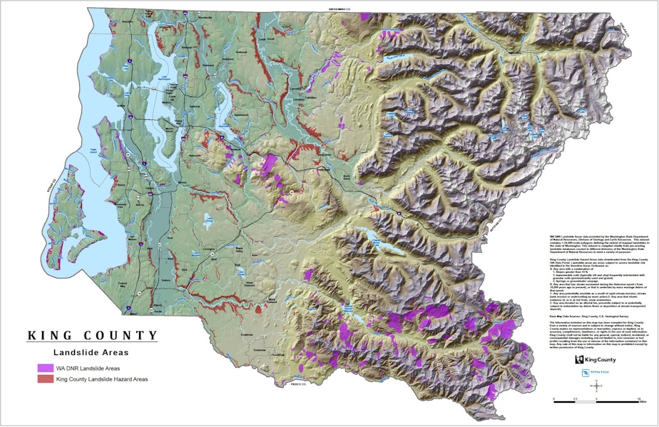
The county's current landslide hazard map was drawn in the 1990s. It's an image that shows two kinds of landslide hazard zones but provides little information about the nature of the risks. It also does not zoom down to street level, so potential developers and property buyers often can't apply the information to a specific property.
Technology has advanced since then, and the county says that with federal funding it can produce a map that will provide a level of detail that will allow some decision-making.
Among the county's choices: It could use the new data to place notices on the titles of homes and other buildings judged to be in landslide zones. The action would mean property buyers would have information prior to purchase.
"If you are a potential buyer of a property, that would be a level of awareness that you don't have now," said John Starbard, director of the county's department of Permitting and Environmental Review, said in an interview. "It likely would cause some follow-up questions from a potential buyer about "tell me more about this risk."
Starbard said the county hasn't made a decision about putting notices on titles, but that is an option. Another option is a public information campaign similar to the "call before you dig" campaigns that taught people to check with utilities before digging. This one would urge residents to look at the map before they build or buy.
Earlier, Snohomish County council declined to pursue a moratorium on development proposed in the wake of the Oso slide. Council will meet again in two weeks to consider temporary controls on development while the county considers permanent changes to its development codes.
County politicians had been shaken by the realization that damage from the Oso slide far exceeded planners' worst-case scenarios. The county had considered leaving a half-mile setback zone around every landslide risk area in the county.
But Dave Somers, who had proposed the moratorium, was forced to drop the idea when new information came to light. He said that most of the county is within a half mile of a landslide hazard zone. Flood plains, he said, would be among the few places left.