County Officials Say Stricken Neighborhood Made Aware Of Landslide Risk

With the death toll expected to rise from Saturday’s catastrophic landslide near Oso, Snohomish County officials and emergency planners are starting to field hard questions about permitting home construction in a known landslide zone.The hillside that unleashed that torrent of mud and destruction on Saturday has a long history of prior slides. This one is the largest in recent memory.
Snohomish County emergency management director John Pennington contends nearby homeowners “were very aware of the slide potential.” He says his office had nothing to suggest a specific warning of imminent danger needed to go out on Saturday.
“We’ve done everything we could to protect them. We’ve mitigated the landslide from 2006. There’s been warnings and advance notifications of the high risk for landslides. We’ve done everything that we could. My heart goes out to all of these individuals. We’re going to get to the bottom of this,” Pennington said.
One valley resident who came by the incident command post to inquire about missing friends says she doesn’t blame the county. The student, who did not wish to be identified, says she was raised in nearby Darrington. She agrees the landslide risk was known, but says no one was prepared for the magnitude of what broke loose Saturday.
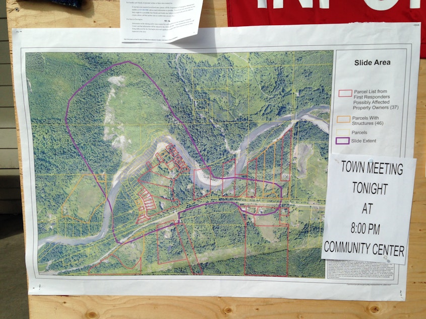
Photo: Aerial view of the mudslide and subsequent backup of the Stillaguamish River seen on March 23, 2014, between Darrington and Arlington, Washington.