King County To Revise Map Of Landslide-Prone Areas
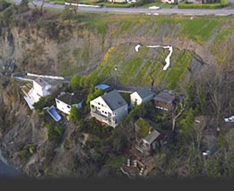
This historical photo shows the 1996 Perkins Lane landslide in the Magnolia neighborhood of Seattle.
Courtesy Washington State Department of Ecology
Marcie Sillman talks to John Starbard, director of King County's Department of Permitting and Environmental Review, about the county’s effort to map out areas that might be prone to landslides and earthquakes.
